After a brisk, blustery start to the week with temperatures dropping to around the freezing mark overnight, prompting some frost advisories, the region will soon be seeing a dramatic turnaround in temperatures.
High temperatures will soar into the low to mid-70s Thursday, Oct. 26 through Saturday, Oct. 28, according to the National Weather Service. In fact, the mercury could even hit 80 degrees in some spots.
On both Tuesday, Oct. 24, and Wednesday, Oct. 25, temperatures will gradually start to climb with the high in the low to mid-60s both days with mainly sunny skies.
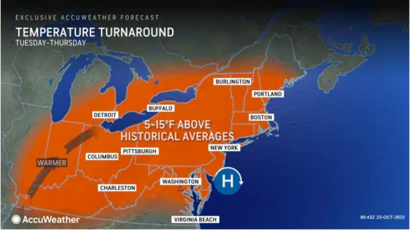
Starting Thursday, temperatures will be at least 5 to 10 degrees above the historical average later in the week. (See the image above from AccuWeather.com.)
The warmest day of the stretch looks to be Saturday, with high temperatures generally in the mid-70s expected, with some spots seeing the mercury climb to the upper 70s.
It's also likely we'll finally see the end of a seven-week stretch in which there has been precipitation on at least one weekend day, though a passing shower on Sunday, Oct. 29 can't be ruled out.
Temperatures are also expected to be more seasonable on Sunday, with the high in the mid-60s.
Check back to Daily Voice for updates.
Click here to follow Daily Voice Peekskill and receive free news updates.